
















The sparsely populated Rotherhithe peninsula was originally wet marshland alongside the river. It was unsuitable for farming, but its riverside location just downstream from the City of London made it an ideal site for docks. The area had long been associated with maritime activities: in July 1620 the Pilgrim Fathers' ship the Mayflower sailed from Rotherhithe for Southampton, to begin loading food and supplies for the voyage to New England, and a major Royal Navy dockyard was located just down the river at Deptford. In 1696, Howland Great Wet Dock (named after the family who owned the land) was dug out to form the largest dock of its time, able to accommodate 120 sailing ships.
By the mid-18th century the dock had become a base for Arctic whalers and was renamed Greenland Dock. However, by the 19th century an influx of commercial traffic from Scandinavia and the Baltic (principally timber) and Canada (foodstuffs for London's population) led to Greenland Dock being greatly expanded and other docks being dug to accommodate the increasing number of vessels. Eventually, 85% of the peninsula, an area of 460 acres (1.9 km²), was covered by a system of nine docks, six timber ponds and a canal. Several of the docks were named after the origins of their customers' cargos, hence Canada Dock, Quebec Pond, Norway Dock and Russia Dock. The Grand Surrey Canal was opened in 1807 to link the docks with inland destinations, but proved a commercial failure and only 3½ miles of it were ever built.
The docks evolved a distinctive working culture, quite different from that of the Isle of Dogs across the river. A characteristic sight of the docks were the "deal porters", dockers who specialised in carrying huge baulks of deal (timber) across their shoulders and wore special headgear to protect their heads from the rough wood.
The decline of the docks set in after World War II, when they suffered massive damage from German air raids. The South Dock was pumped dry and used for construction of some of the concrete caissons which made up the Mulberry Harboursused on D-Day. When the shipping industry adopted the container system of cargo transportation, the docks were unable to accommodate the much larger vessels needed by containerisation. They finally closed for lack of custom in 1969. The Grand Surrey Canal was closed in 1971 and was subsequently drained and filled in. The area remained derelict for over a decade, with much of the warehousing demolished and over 90% of the docks filled in. The only surviving areas of open water were Greenland Dock, South Dock, remnants of Canada Dock (renamed Canada Water), and a basin renamed Surrey Water. In 1981, the Conservative government of Prime Minister Margaret Thatcher established the London Docklands Development Corporation to redevelop the former dockyard areas east of the City of London, including the Surrey Docks.
During the 1980s and early 1990s, the Surrey Docks were extensively redeveloped, and renamed Surrey Quays. Over 5,500 new homes were built, ranging from individual detached housing to large apartment complexes. South Dock was converted into a marina - now the largest in London - and a watersports centre was constructed on Greenland Dock. Canada Water and the infilled Russia Dock became wildlife reserves, with a woodland planted on the latter site. Most of Norway Dock was re-excavated to form a water feature surrounded by residential development, and another ornamental feature, the Albion Channel, was created along the eastern side of the former Albion Dock, linking Canada and Surrey Waters. Leisure facilities and a number of light industrial plants were also built, notably a new printing works for Associated Newspapers, the publisher of the London Evening Standard and the Daily Mail.
In October 1988, the Surrey Quays shopping centre was opened as the centrepiece of the redevelopment (and rebranding) of the area. The nearby London Underground station was renamed as Surrey Quays a few months later.
1971. Surrey Docks
Entrance to Surrey Docks looking east. The office building on the right after being the docks offices was used by Goldsmiths Art College.
2002. Surrey Docks Entrance
Surrey Quays road entrance looking towards Canada Water tube station with the old dock offices still standing.
2018. Surrey Docks
The old entrance to the docks has become a public transport thoroughfare leading to Canada Water Tube and shopping centre.
1971. looking west towards Surrey docks entrance showing Columbia and Regina points, 21 storey blocks of flats built by The Greater London Council 1962-64.
2003. Canada Water, Surrey Docks
View towards Surrey Quays road entrance with new Canada Water tube station now in front of Columbia and Regina points.
2018.Canada Waters, Surrey Docks.
Deal Porters market square , Olympia towers, Surrey Waters library with the old blocks behind Canada Waters Underground and bus terminal.
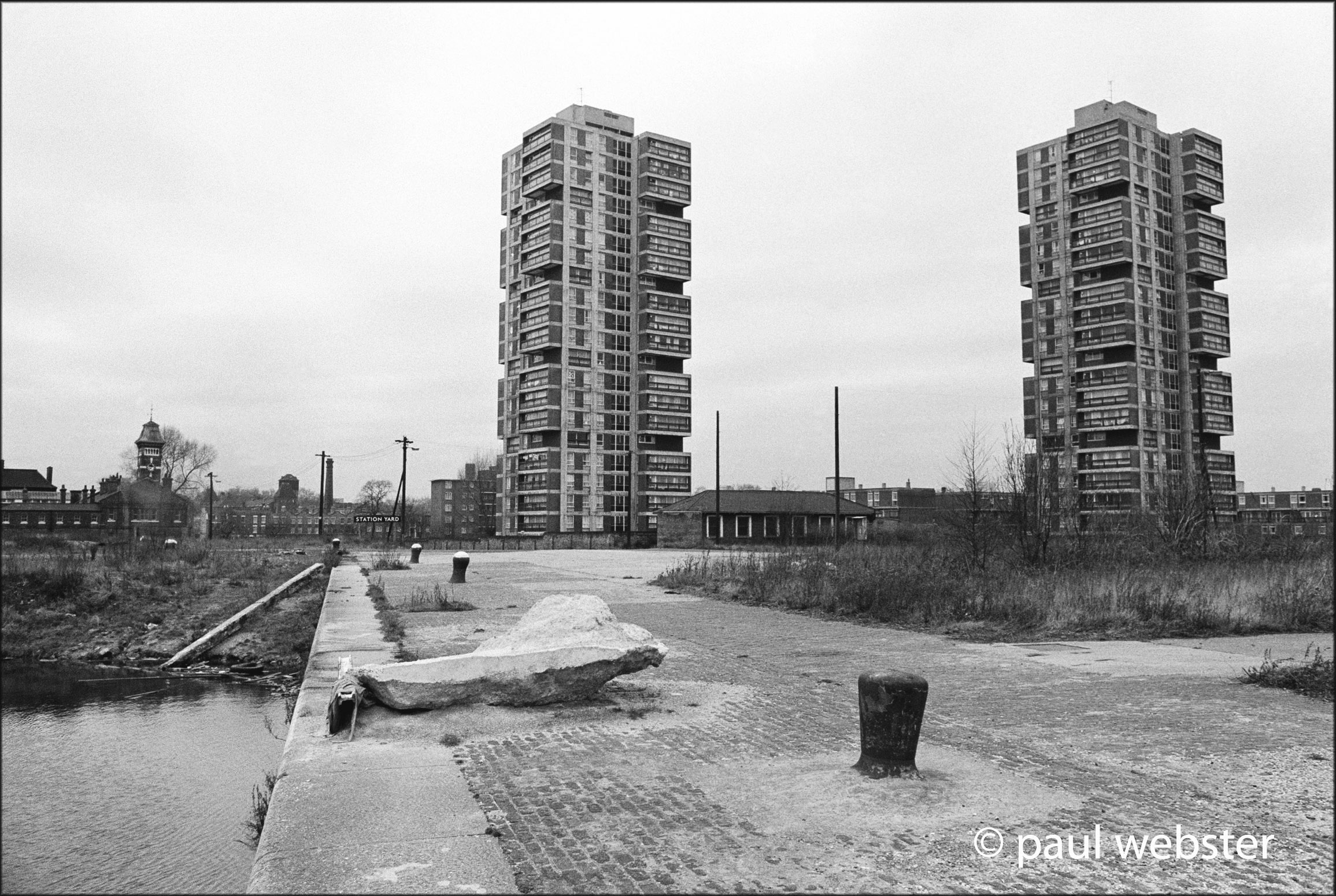
!972. Regina point, Surrey Docks
Albion Yard with Regina point flats behind.
2003. Regina Point, Surrey Docks
Albion yard no more, a bus station and Canada Water tube station in front of Regina Point.
2018. Regina Point, Surrey Docks
Regina Tower now seen from Deal Porters market with Olympia Tower to the right and the new Surrey Waters Library to the left, and skate boarders in the centre.
1971. Albion Dock
Looking north towards the Thames from the channel between Canada water and Albion Dock.
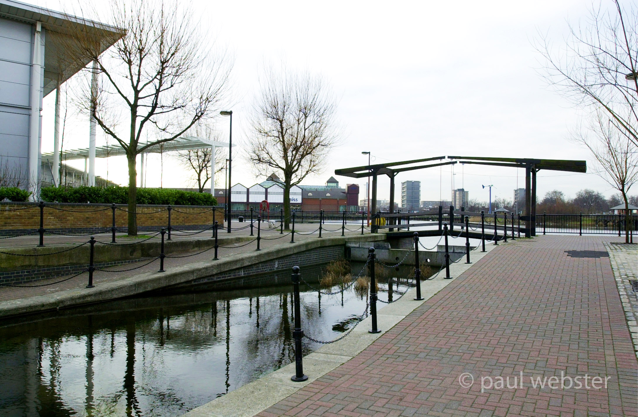
2003. Albion Dock
The old dock has become a canal leading to smart new housing developments.
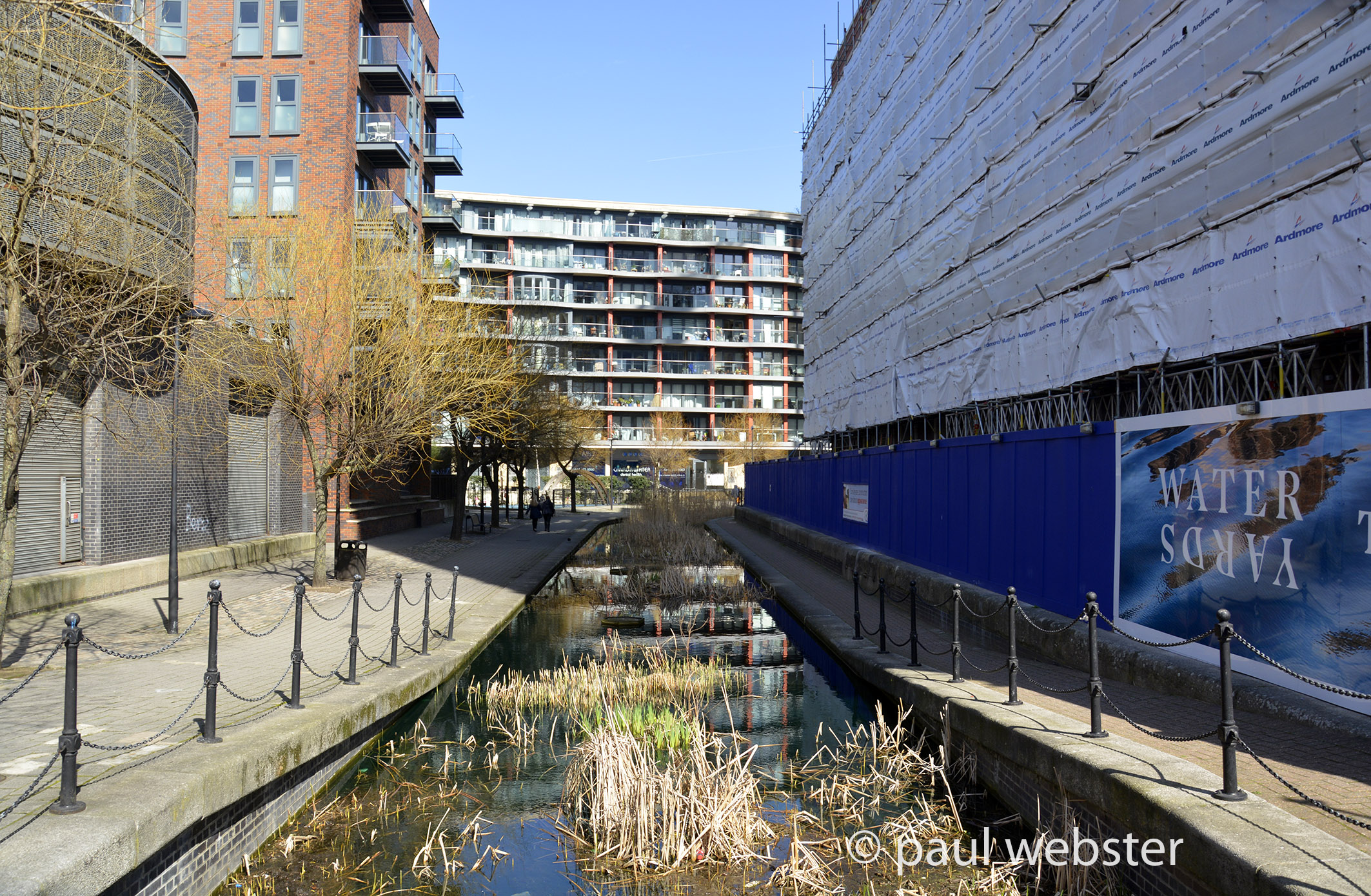
2018. Albion Dock, Surrey Docks.
Albion channel, on the right another block of apartments on its way.
1970. Albion Dry Dock
The small original dry dock for Surrey Docks with a view across Albion Dock.
2003. Albion Dry Dock
The dry dock is now filled, a channel has been created where the dock was and further new apartment blocks have been constructed.
2018. Albion Dry Dock, Surrey Docks.
View from the remains of the Albion Dry dock with my back to the hoardings of another new development in this now very populous residential area.
1970. Canada Dock
Albion to Canada dock looking south east, the old timber warehouses to the left.
2003. Canada Water
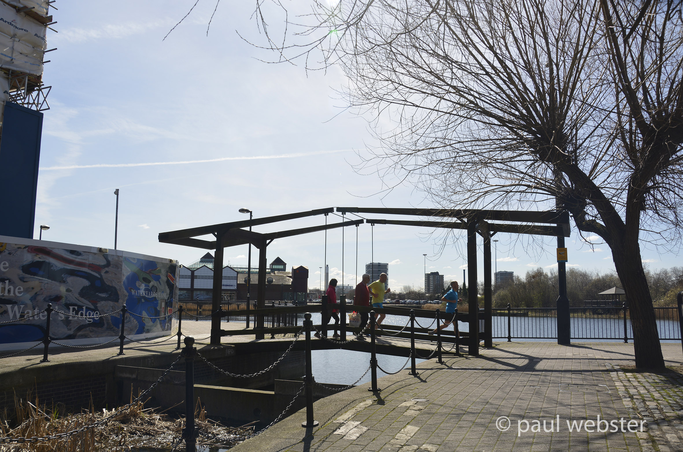
Albion canal to Canada Water shopping centre with new megastores to the left. The pedestrian bridge links the Canada Water tube and bus station to the new sports stores.
2018. Canada Waters
Surrey Docks ( Canada Water ) shopping centre beyond seen from Albion channel where another new apartment complex is under way. The decorative channel needs some attention as weeds are proliferating.
1970. Albion Yard
Looking north to the Thames and Albion Dock
2003.Albion Yard
a major housing development alongside the newly created canal which was Albion Dock..
1970. Canada dock
Looking south east from the road entrance across Canada Dock to the timber warehouses.
2003. Canada Water
A large part of Canada Dock filled for parking spaces accessing the new shopping centre.
1970. Canada dock
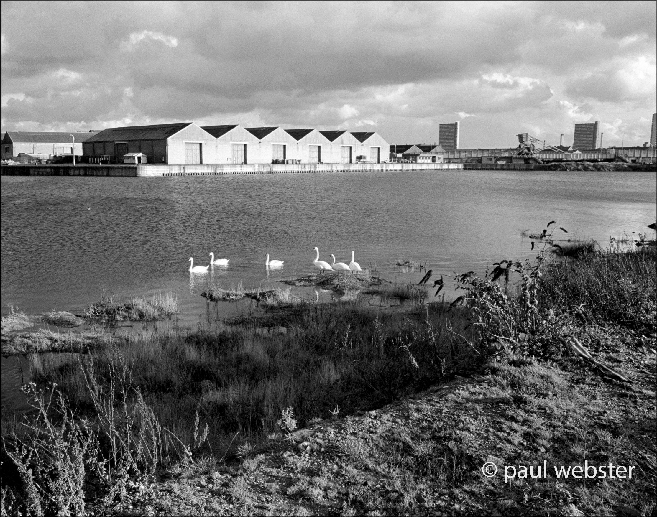
N.E. view of the disused dock with weeds growing and warehouses deserted.
2003. Canada Dock
Canada Water , as it is now known, with new superstores and shopping centre.
2018. Canada water, Surrey Docks.
The old dock is now home to swans and ducks, the shopping centre and sports stores nearby become busier as more residential quarters are built.
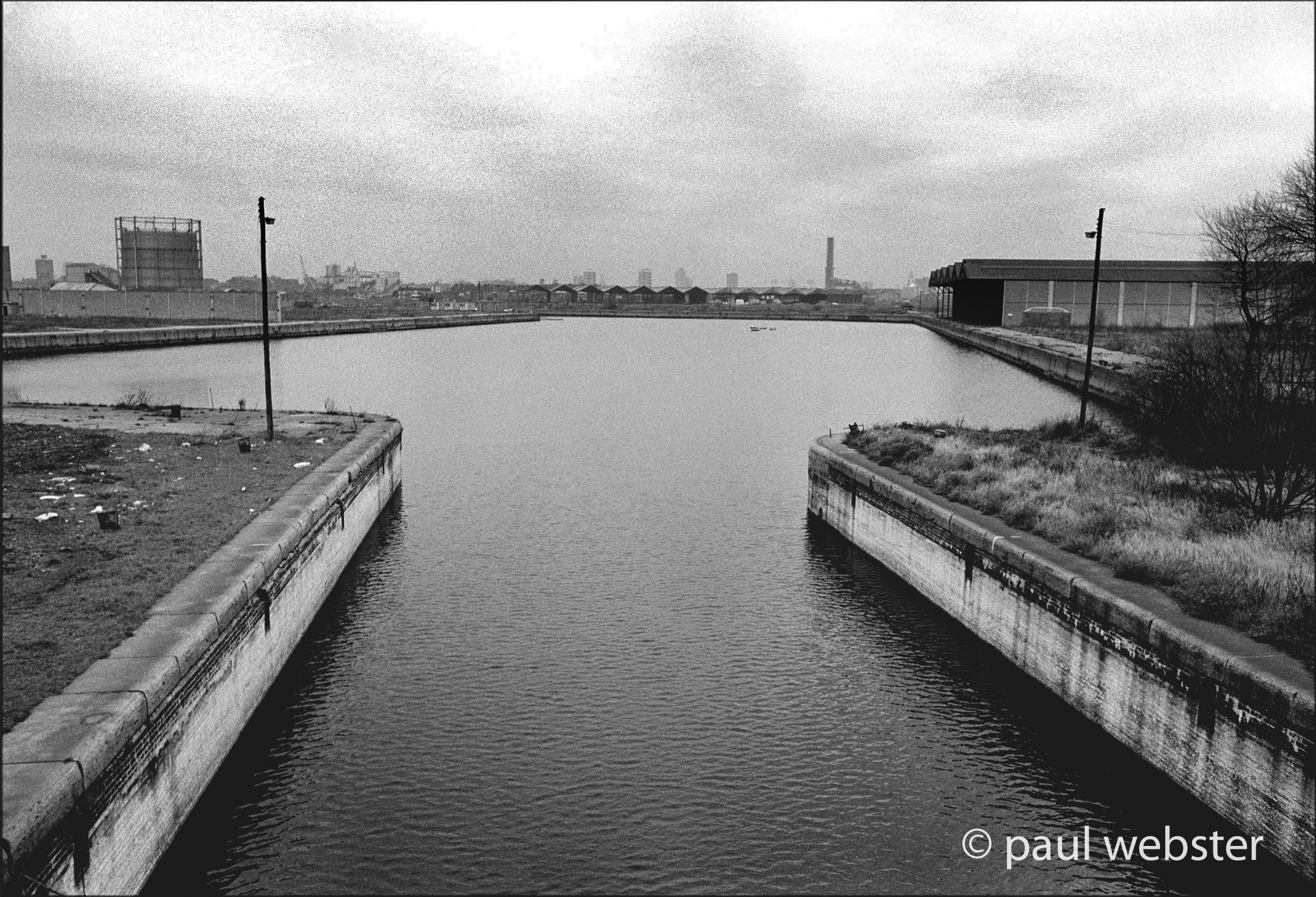
1970. Greenland Dock Entrance
Lock gates at the dock entrance looking across to West India Docks
still in operation.
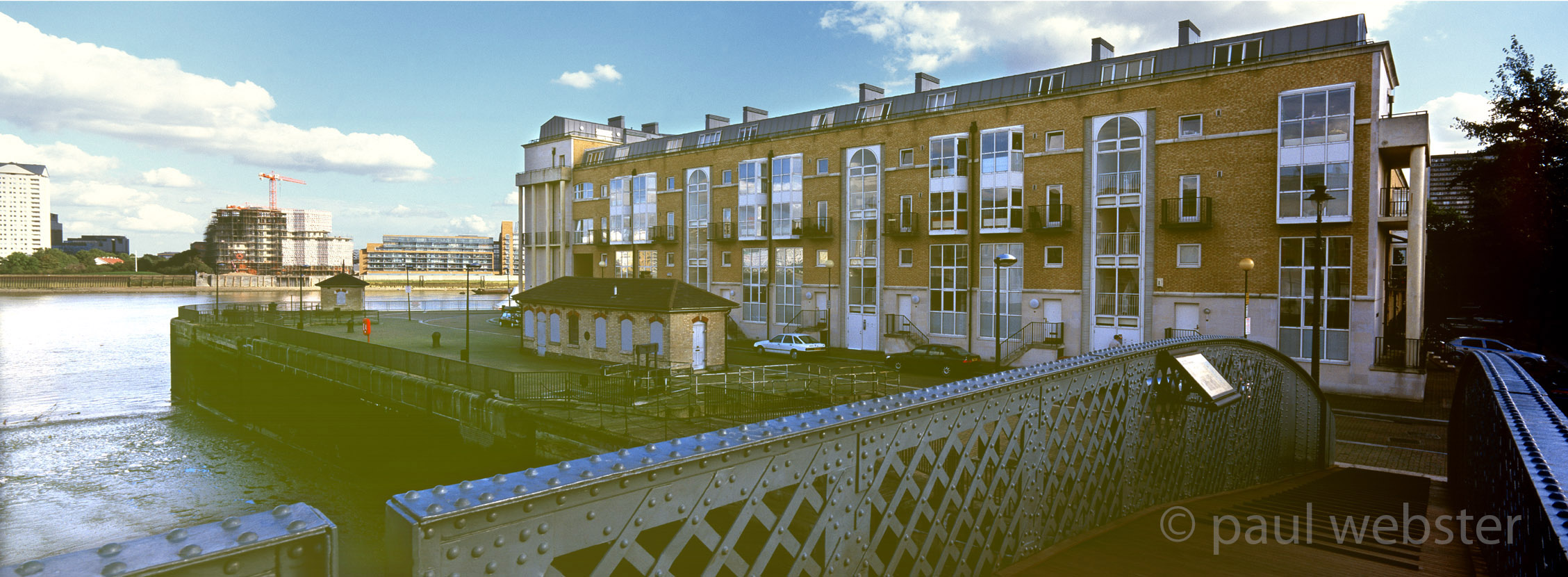
2004. Greenland dock entrance
Construction of the Citibank building in Canary wharf visible in the distance and new apartment blocks each side of the old entrance.
2018. Greenland dock entrance
No longer viable as a shipping route, new apartment and office buildings constructed on the Isle of Dogs and more to to follow.
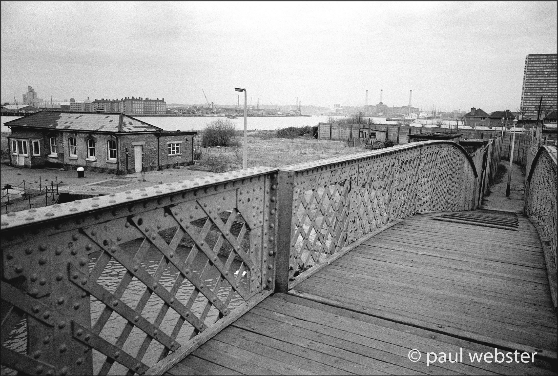
1970. Surrey Docks
Greenland dock entrance bridge looking down the Thames to the future site of the barrier.
2003. Greenland dock entrance
Looking East to the Isle of Dogs from the pedestrian bridge.
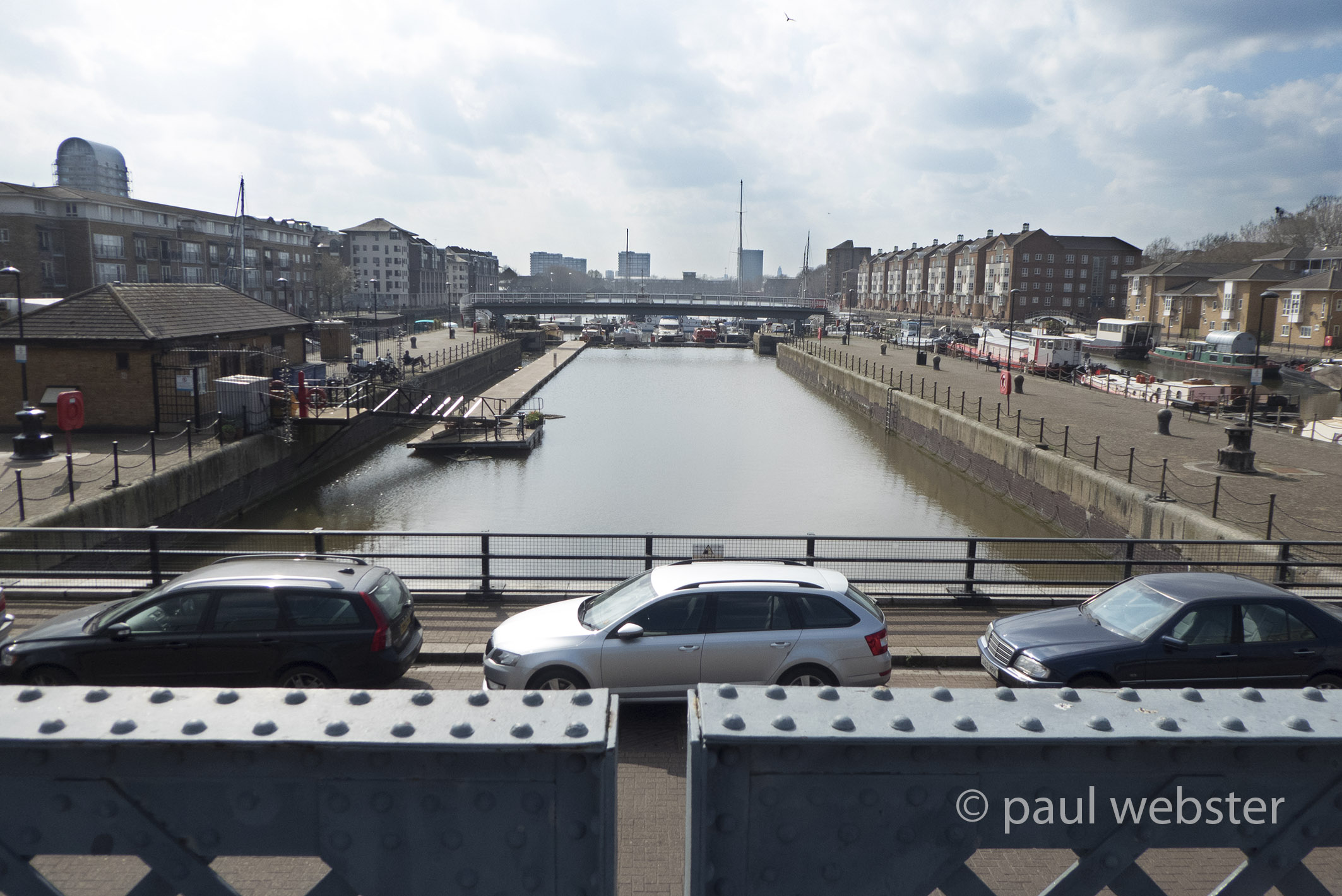
2018. Greenland Dock entrance
Many new residential and office blocks visible on the Isle of Dogs across the Thames.
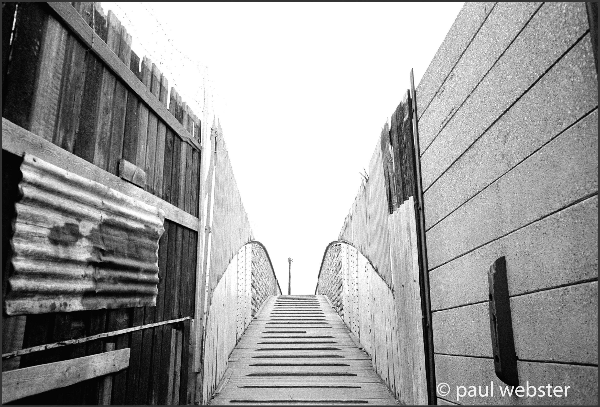
1971 Greenland docks
Pedestrian bridge across the entrance to Greenland Dock
2003 Greenland dock entrance bridge
Restored, repainted and functioning as a pedestrian walkway but no longer functioning as a swing bridge.
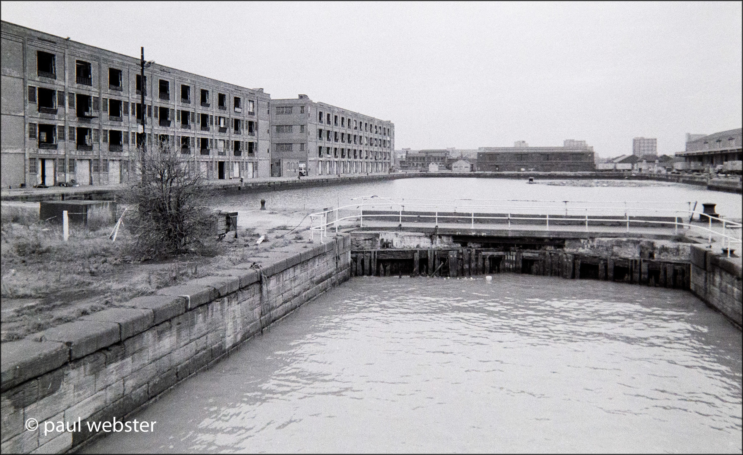
1971 Greenland dock
View from the pedestrian bridge to the inner lock gates of Greenland Dock.
2003. Greenland Dock
Alive again and filled by pleasure boats and now a new residential quarter with many blocks of flats constructed and occupied.
2018. Greenland Dock
residential barges and cruisers now mainly to the east in South Dock where access is available to the Thames.
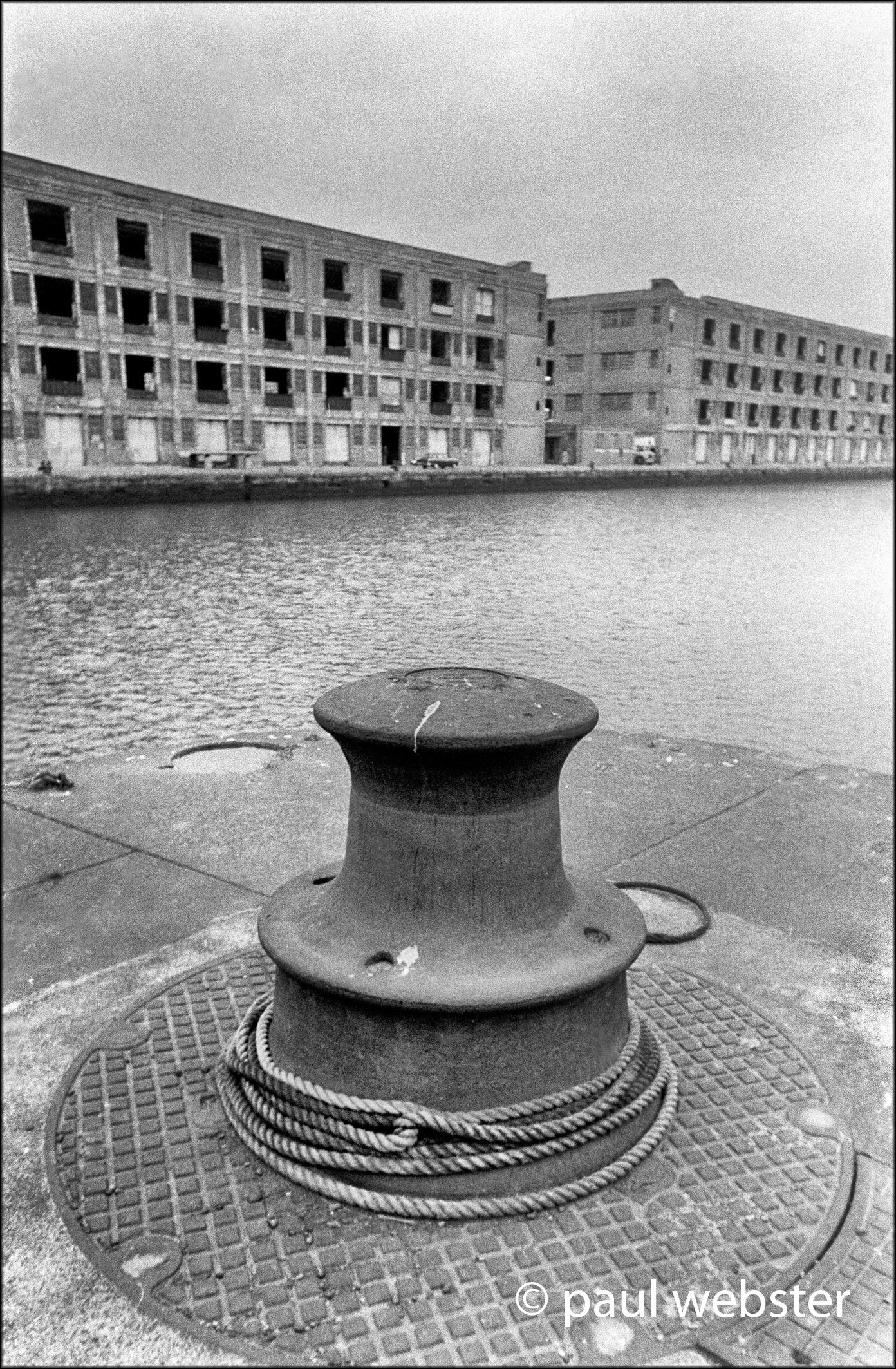
1971. South Dock
Abandoned warehouses in Surrey’s South Dock.
2018. South Dock Marina
Now fully developed and occupied by pleasure craft and residential barges with a fully functioning access route to the Thames.
1971. South Dock
The entrance from the Thames sealed and warehouses derelict.
2018. South Dock Marina
Occupied and fully developed seen from the access way to the Thames. The crane on the left is for lifting boats out for maintenance.
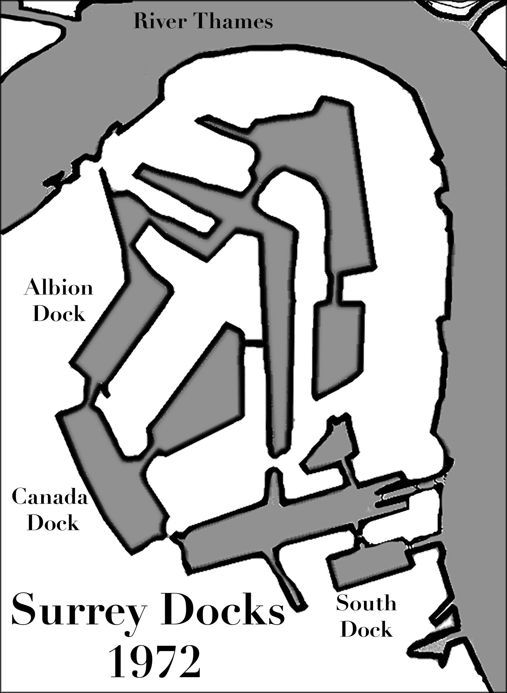
Map of Surrey Docks 1972
All the main docks were still in existence but none were in use except Greenland Dock and South Dock.
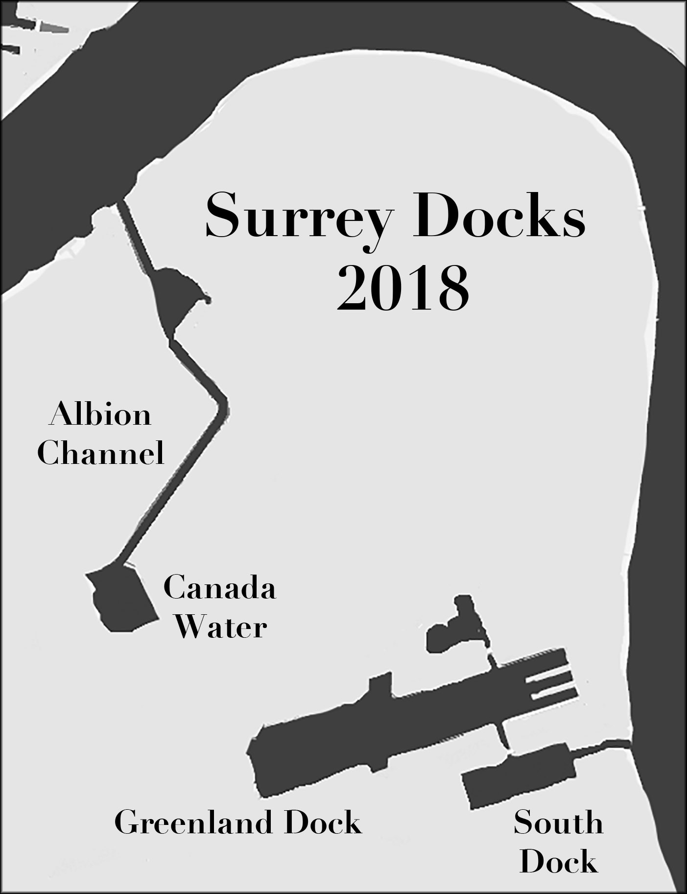
Map of Surrey Docks 2018
Apart from Greenland Dock and South Dock all the other docks have been filled. Canada Water, which was Canada Dock, remains as a decorative lake with swans and ducks giving a pleasant aspect to the new theatre, shopping centre and blocks of rental apartments.